



The following are the top five technical applications of satellite imagery in 2026.
Tuhin Sarwar OSINT Intelligent Journalist. Dhaka, Bangladesh 15 September 2026
- The following are the top five technical applications of satellite imagery in 2026.
- 1. Accurate Monitoring of Remote Forest Wildlife Habitats and Deforestation Prevention
- 2. Satellite data and artificial intelligence can also detect illegal logging and forest encroachment.
- 3. Urban Planning and Infrastructure Development
- 4. Defence, Security, and Surveying
- 5. Natural Resource Management and Mining
Satellite imagery has become an essential tool in contemporary, technology-driven journalism, particularly in Open Source Intelligence (OSINT). This technology has transformed various fields, including defence, criminal investigations, and agriculture. Satellites capture high-resolution images of Earth from space, providing invaluable information and insights that aid in crime identification and decision-making, enhance predictive analytics, and pave the way for innovative solutions. This article will cover five major uses of satellite imagery in journalism and their implications for the future of this technology.
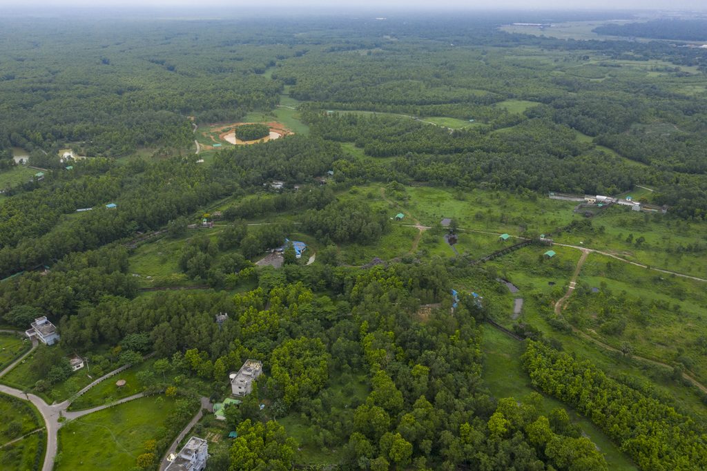
1. Accurate Monitoring of Remote Forest Wildlife Habitats and Deforestation Prevention
“Precision forestry” dominates satellite technology, enabling unprecedented forest resource management, conservation, and development. The main uses of satellite imaging for precision forestry are:
Deforestation prevention: Detecting illegal logging and forest boundary encroachment.
Monitoring smoke and forest temperature early can prevent wildfires.
– Finding new tree planting sites using soil moisture and terrain data.
– Early pest and disease detection: Infrared imaging can detect leaf withering and other disease signs early.
Measure biomass to calculate forest CO₂ absorption.
Remote biodiversity monitoring: Tracking wildlife migration and habitats.
Precise monitoring of wildlife habitats in remote forest areas and prevention of deforestation is key. This section can be formal and educational. For instance, “Satellite imaging enables precise monitoring of wildlife habitats in remote forest areas.” Real-time surveillance can stop illegal logging and deforestation.
Professionals and educators can note that “Wildlife habitats in remote and inaccessible forest areas can now be precisely mapped and monitored thanks to advanced satellite technology.”
2. Satellite data and artificial intelligence can also detect illegal logging and forest encroachment.
Satellite imaging has transformed precision forestry, especially for remote wildlife habitat monitoring. Remote sensing and high-resolution satellite imagery can track wildlife ranges, migratory routes, and ecosystem changes in inaccessible deep forests. The technology speeds up biodiversity conservation decisions. Our AI and real-time satellite data can detect forest changes of any size. Law enforcement and rangers can quickly address illegal logging, forest encroachment, and wildfires. To protect forest borders and sequester carbon amid climate change, we need satellite monitoring. For precise forest management and wildlife and resource protection, satellite technology is revolutionary.
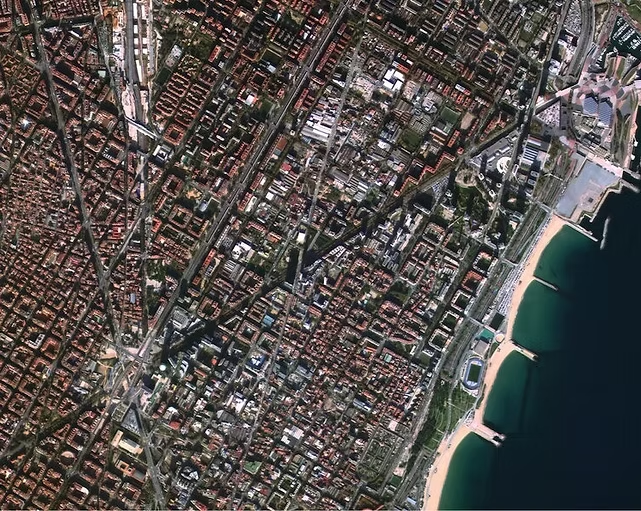
3. Urban Planning and Infrastructure Development
Cities are increasingly using satellite imagery for urban planning and infrastructure management. High-resolution satellite maps allow city planners to monitor urban sprawl, design transportation systems, and optimise land use. Additionally, remote sensing is crucial for assessing both the short- and long-term impacts of construction and development, and it promotes sustainable practices.
Benefits:
– Efficient urban planning and traffic management
– Enhanced disaster resilience in urban environments
– Real-time monitoring of construction and infrastructure
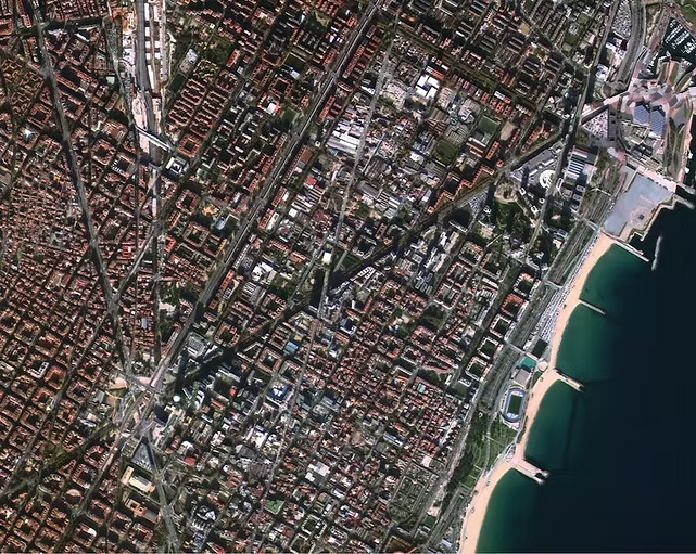
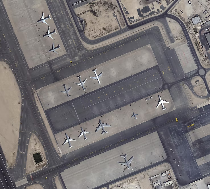
4. Defence, Security, and Surveying
Satellite imagery plays a crucial role in defence and security operations. National governments and defence agencies rely on it for monitoring borders, conducting reconnaissance, and identifying potential threats. The use of high-resolution imagery enables military forces to make informed decisions and respond effectively to unforeseen events during military operations, counterterrorism efforts, and intelligence-gathering activities.
Benefits:
- Strategic planning and situational awareness
- Improved national security and border monitoring.
- Real-time global conflict and risk monitoring.
5. Natural Resource Management and Mining
effects and applications of remote sensing, or satellite imagery, in the management and extraction of natural resources (such as water, oil, and minerals). Monitoring operational and environmental effects, evaluating rich resources, and optimising resource capability are all made easier by remote sensing. We control risk and resource sustainability throughout the exploration and resource development process.
Benefits:
– Increased productivity in the exploration of minerals and energy
– Environmental impact assessments (and mitigation)
– Management of operational and emergency safety (and expense)
Satellite imagery was once primarily thought of as a tool for space exploration. But it has now developed into a technology that promotes innovation in several industries. Meaningful, accurate, precise, real-time, high-value, and actionable intelligence has many uses in fields such as environmental monitoring, agriculture, and defence. This technology is expected to give industries all over the world fresh perspectives and encourage better, data-driven decision-making.
Tuhin Sarwar is an investigative journalist and editor and OSINT analyst. Editor, Article Insight, native of Bangladesh